Humber (East Riding of Yorkshire) 24 Feb., 2019
Keywords: Tidal flat, Bedform, Sedimentology
I visited Humber to observe mudflat.
Humber is large estuary on the eastern coast of Northern
England (Fig. 1).
 |
| Fig. 1. Location of Humber River. |
I observed the northern tidal flat near Humber bridge in
Hessle. Gravel beach, marsh, gravel and mud flat, mud flat and gravel and mud
flat are developed there from land to river (Fig. 2).
 |
| Fig. 2. Whole view of tidal flat of Humber and Humber bridge in Hessle. Gravel beach, marsh, gravel and mud flat, mud flat and gravel and mud flat are developed from land to river. |
Some bedform and structures are developed on the mud (Fig.
3).
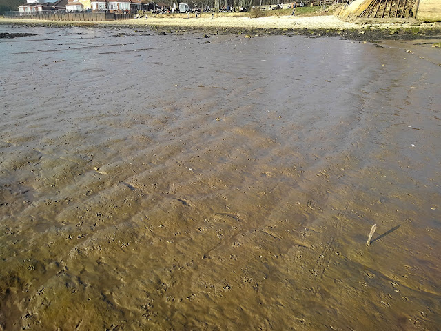
On the landward side, dune-like structures which oriented perpendicular to
the river developed (Fig. 4). The wave length is around 40 - 60 cm and the
height is less than 5 cm. These structures are small channels and may be originated from dune.
 |
| Fig. 4. Dune-like structures on the mud in landward side. |
On the other hand in the riverward side, small-scaled cuesta
which is parallel to the river is developed (Fig. 5).
 |
| Fig. 5. Small-scaled cuesta on the mud in the riverward side. |
It seems to be formed by
erosion in water front and alternated beds due to tidal cycles (Fig. 6).
 |
| Fig. 6. Close up of water front. Wave erodes the mud and makes stepped structures. |
The
boundary of these areas with different structures are clear. It is interesting research topic to clarify what control the differences and the boundary.

